
Cartography
World Map
Readings of the known ground around Megacity One — ink surveys in the house style, and the illuminated chart that first marked the margins.
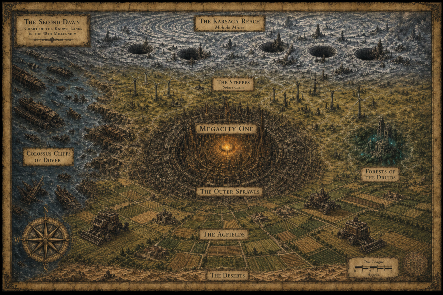
Topographical maps of the Second Dawn
Plate SD-WM-03
Ink Survey
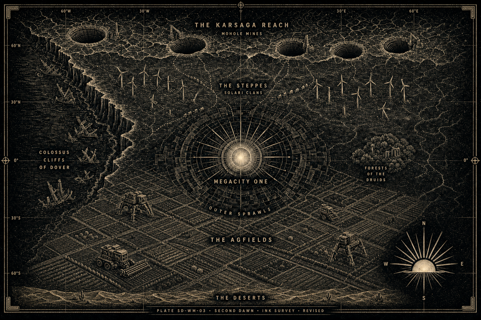
Plate SD-WM-05
Illuminated Chart
Regions
8 marked
- North
The Karsaga Reach
Frozen industrial waste. Mohole Mines — open crustal pits with drilling rigs — dig the helium-three that feeds the Mega City cores.
- North-central
The Steppes
Grasslands of the Solari Clans beneath rusted wind farms. Many of their people — and the ethnic minorities among them — migrate north to work the Moholes.
- Center
Megacity One
The vertical hive at the heart of the Second Dawn — arcologies, Gen Pop stacks, and the Regime's grip.
- Ring
The Spill
Overflow dens beyond the formal stacks — thinner protection, Seer markets, and the soil Resistance fishes.
- South
The Agfields
Endless pastoral farmland south of the hive — the Regime's bread. Banal Lords in brutalist keeps; the Corvée owed on the strips; Partisans cutting the harvest machines.
- Far south
The Deserts
A last rim of arid waste at the southern edge — dunes and static heat where the Agfields finally give out.
- West
Colossus Cliffs of Dover
Rusting coastline of wrecked ships and orbital scrap. Home of the Dover Scavs.
- East
Forests of the Druids
A small techno-pagan enclave — bioluminescent woodland and overgrown machine-gods outside Regime rule.